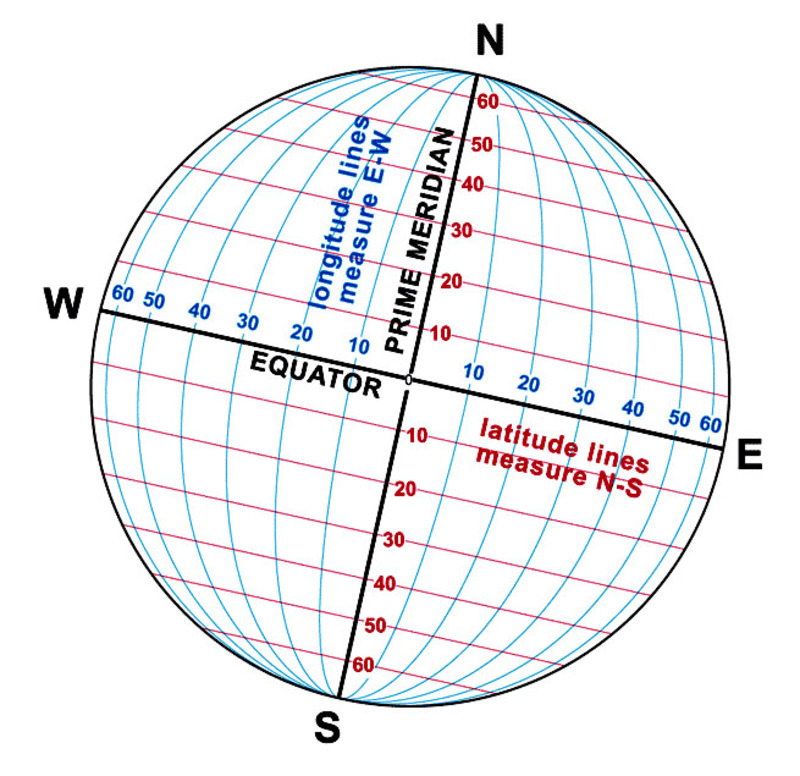
Thomas Jefferson envisioned the Lewis and Clark Expedition as a scientific expedition, but also hoped it would find a practical commercial route to the Pacific. Not only did Jefferson want the information that expedition obtained, he wanted an accurate map of the country through which it passed. To make an accurate map of such a large area would require accurate locations of river junctions, rapids, falls, mountain passes, and native settlements. Jefferson knew that such a map could not be made from a survey using just a magnetic compass and estimated distances. The solution -- find the latitude and longitude of important points along the route and adjust the compass survey to them. Latitude is the angular distance north or south of the equator. The latitude at the equator is 0° at the poles it is 90°. Longitude is the angular distance east or west of the Prime Meridian (the north-south line through Greenwich, England); the longitude there is 0°. From the Prime Meridian the longitude increases eastward (east longitude) to 180° and also westward (west longitude) to 180°. The intersection of a parallel of latitude with a meridian line of longitude marks the location of a unique spot on the surface of the earth. In the early 19th Century, latitude and longitude usually were determined from celestial observations taken with a sextant or octant and chronometer. Lewis purchased this equipment in 1803. He also received training in how to make celestial observations and calculate them. From this training Lewis taught William Clark. Clark already knew how to use a magnetic compass to survey and he had a talent for map drawing. The expedition's route survey would be made with a magnetic compass. The captains, therefore, also needed to make observations to determine how many degrees the compass needle pointed away from true north (that is, the magnetic declination). The celestial observations the captains took would fix the latitude and longitude of important river junctions and, by knowing the magnetic declination, the survey made with the magnetic compass between those points could be corrected to true north. From this, a cartographer could produce an accurate map.